Valid XHTML 1.0!

MARFLEET Family History

Marfleet's Bridge

Marfleet's Bridge
Marfleet's Bridge, from the Eastville road looking east

George (1783-1831) and Mary (1785-1851) MARFLEET lived in a house on the Friskney to Wainfleet Saint Mary road, where it crosses the Eastville road. (O.S. TF475575) This point can also be considered the beginning of the Fodder Dike which travels inland in a westerly direction until it joins the Hobhole Drain. Looking at the site today, it is difficult to realise the importance with which these water-ways were once regarded. They were the very veins of life for the fens, bringing trade, commerce and a means of communication. George is listed in contempory directories variously as boatman and brickmaker. The brick pits which were constructed on land immediately to the north of the house (plot 280 on the 1838 Tithe Map) provided a ready cargo, and it is certain that George would make his own bricks and then transport them throughout the fens and possibly much of the county. He would also act as water-bourne carrier, transporting the various commodities, perhaps cereals or beet, of his neighbours. (See also, newspaper report of the attempted murder of one of George's sons.)

Marfleet's House
Marfleet's House before restoration in 1951

The pond which formed naturally in the redundant brick pit was deemed to be a health hazard and was consequently filled in by the local authority some years ago.

Hoyle's Mill,
Marfleet's Bridge,
Friskney.

25-6-35
538811
Hoyle's Mill 
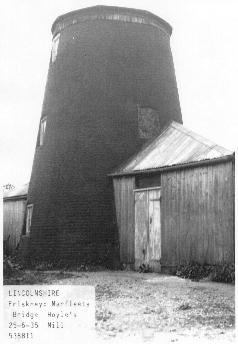
Reproduced from the "Donald W.Muggeridge Collection", Templeman Library, University of Kent at Canterbury, by permission of the Librarian. For further information on this and other Windmill Collections contact:- S.A.Crabtree@ukc.ac.uk

White's 1856 Lincolnshire Directory records Robert Hoyles as a corn miller at Lowgate and the 1876 Directory for Lincolnshire, published by the Post Office, records Joseph Hoyles as one of three millers in Friskney. It is not yet known when the mill was built or when it was demolished.

Marfleet's House and Bridge
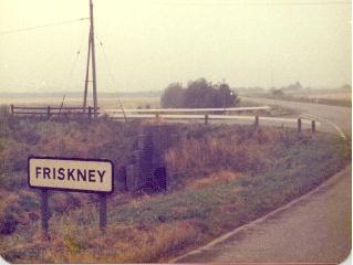
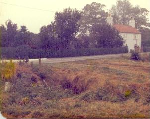
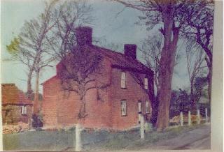
The house and bridge photographed in 1979.


On Tour
The house, photographed on a visit during the
1st International MARFLEET Family Gathering
in June, 1979.


If you are visiting this location, why not also pay a visit to Friskney Decoy Wood, a local nature reserve?
The Decoy Wood lies 1.5 km (0.9 miles) north of Friskney village on the north side of the Fodder Dyke Bank road from Eastville to Friskney. Access is via a footbridge some 500 m west of Marfleet’s Bridge. Cars may be parked at the roadside. Cross the footbridge and follow the field edge path to the reserve entrance. The waymarked route is uneven and care should be taken to avoid exposed tree roots, rabbit holes, tree stumps and fallen branches.

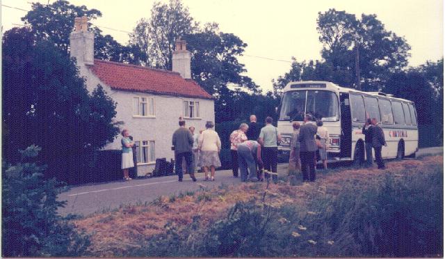
© Marfleet Family History

John's Homepage
Marfleet's Bridge
LAST UPDATED: 28th December 1999.

(Converted to XHTML 1.0 08/08/2005)
Go to Contents
This page contains links to other web-sites. If you experience problems with an onward link, please e-mail me with details so that the problem can be rectified. Thank you.